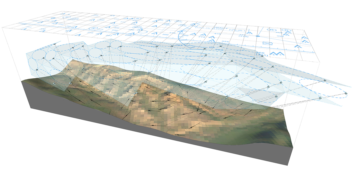


CENTRAL VALLEY, CA - California’s Central Valley comprises a productive, infrastructural landscape arrayed along the spine of Interstate 5. This landscape is the result of the distribution of small-scale “micro-infrastructural" technologies and typologies: for example, the switch from trench irrigation to rotary sprinklers transformed agricultural lot organization from the grid to the dot. When viewed from the air, the proliferation and distribution of these technologies results in new patterns at the macro scale.

This research project envisions a set of case studies for new micro-infrastructural technologies proliferated across this landscape, and the corresponding patterns they create. In one instance, high-altitude wind farms capture energy using a swarm of kites hovering in the jetstream. These are supported by a system of robotic tethers, which in turn are inscribed on the topography.

A matrix of subdivided cattle feed lots feature inflatable canopies that contain the spread of pathogens (minimizing need for antibiotics) and capture methane emissions (to fuel manure-fertilizer digesting silos) as livestock are circulated on a weekly basis.

Serpentine levee networks hybridize with subdivision lot typologies, to support a series of bulwark “double-hull” sites to protect against flooding
